We will address global challenges by providing innovative solutions for a wide range of applications and markets including earth observation, risk analysis, agriculture, forestry, marine environment, disaster monitoring, cultural heritage and archaeology.
MARKET SECTORS
Our Imagery and Video acquisition through our ARTEMIS Satellite Constellation provides services to a wide range of clients from a number of different industries. Our suite of products and services address a broad spectrum of applications to provide timely information on demand.

CREDIT: ESA, Qarhan Salt Lake, China
-
Earth Observation
-
Mapping
-
Natural Resources
-
Marine Environment
-
Forestry
-
Agriculture
-
Utilities
-
Insurance
-
Architecture, Engineering & Construction
-
Cultural Heritage and Archaeology
-
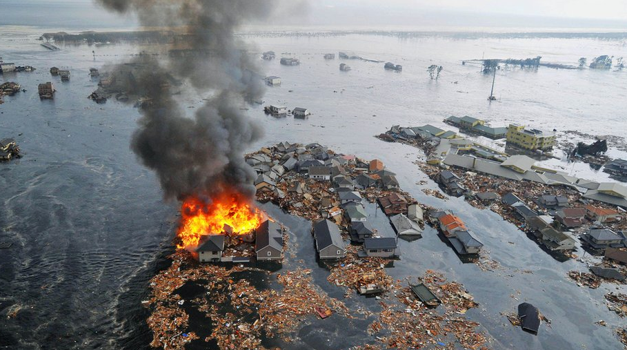
Disaster Monitoring & Humanitarian Relief
Applications
Applications we serve currently are:
Marine Environment

With over two-thirds of our Earth’s surface being covered by water, monitoring of our oceans is critical in providing data on our changing world. The ARTEMIS Satellite Constellation will provide constant monitoring of marine environments to provide data to contribute to understanding climate change, and deliver intelligence and analysis on coastline mapping, sustainable fisheries development, vessel monitoring, and protection of coral reefs along with providing a repository of data which can be accessed by a wide range of users.
…………
………………
……………………………………..
…………………
……………
……….
…….
Agriculture

Our multispectral imagery, video and remote sensing capabilities can analyse and assess crop growth and health of produce through global geographical coverage. Users can identify pest infestation, plan irrigation levels and monitor crops affected by disease through acquiring data that can enable quick decisions and managing their resources.
……..
…………..
…………
………..